Building Accessibility A-G
Explore accessibility details for campus buildings A-G. Accessible routes, entrances, and restrooms are indicated for each building. The information is being provided to help enhance transparency and increase knowledge of the information for event planners, students, and the surrounding community.
Restroom Accessibility Notes:
- "ADA" refers to the Americans with Disabilities Act.
- Any table listed as "ADA Accessible Restrooms" includes accessibility features and ADA/Braille signage.
- Any table listed as "Accessible Restrooms" includes accessibility features but does not currently display ADA/Braille signage.
- The first two digits before a series of numbers indicate what floor the room is on.
- 0010 would indicate either the basement level or the ground floor.
- 0122 would indicate the first floor.
Agriculture Building
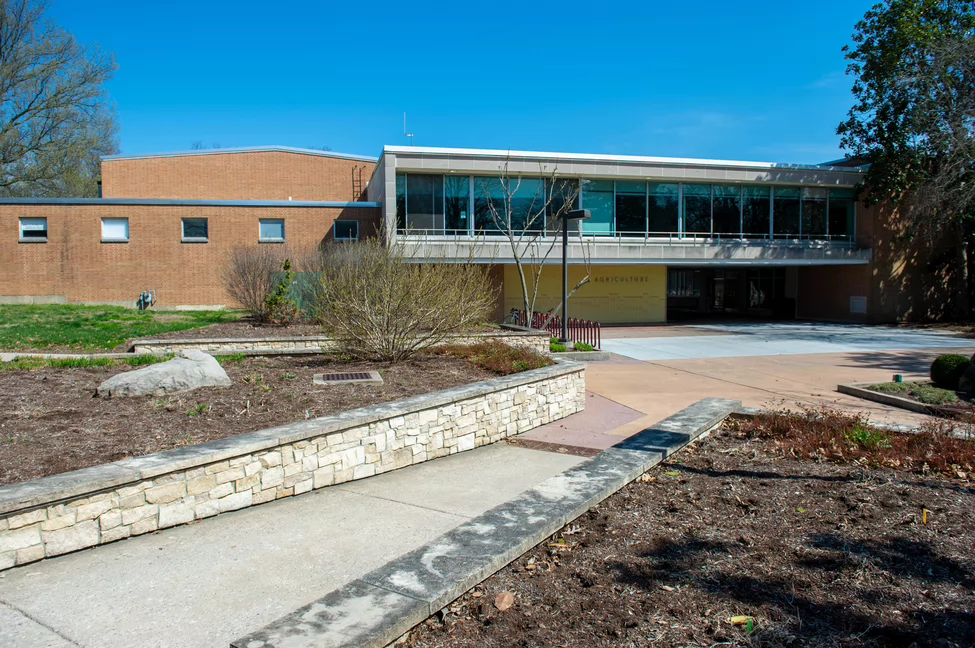
Accessible Entrances and Pathways
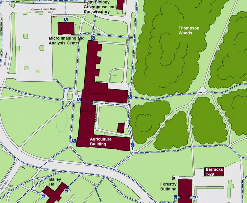
This map does not display every accessible pathway or powered door on campus. Doors marked with “P” indicate powered entrances. Pathways shown with blue dashed lines indicate accessible pedestrian routes.
The Agriculture Building is centrally located and highlighted in dark red. Accessible pedestrian routes are shown as blue dashed lines and connect the Agriculture Building to nearby buildings and surrounding roadways.
To the north of the Agriculture Building:
- Micro Imaging and Analysis Center
- Plant Biology Greenhouse and Conservatory
- Communications Drive
To the east:
- Thompson Woods
- Agriculture Drive
- Accessible pedestrian routes along the roadway
To the south:
- Bailey Hall
- Forestry Building
- Barracks T-29
- Main campus roadway with marked accessible crossings
Powered doors are marked with a “P” symbol at select entrances near:
- Agriculture Building
- Micro Imaging and Analysis Center
- Forestry Building
- Bailey Hall
Accessible pathways connect parking areas, sidewalks, and building entrances throughout the area shown.
Note: This map does not display every accessible pathway or powered door on campus.
| ADA Accessible Restrooms | Room |
|---|---|
| Men's | 0105, 0177 |
| Women's | 0103, 0179 |
Allyn Building
Accessible Entrances and Pathways
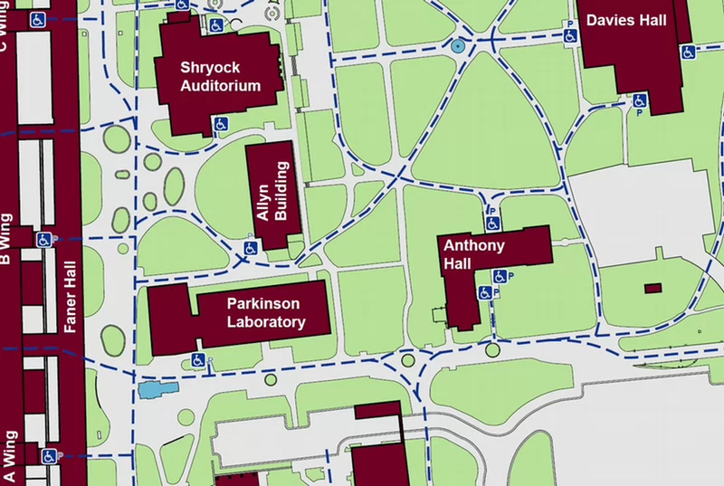
This map does not display every accessible pathway or powered door on campus. Doors marked with “P” indicate powered entrances. Pathways shown with blue dashed lines indicate accessible pedestrian routes.
The Allyn Building is centrally located and highlighted in dark red. Accessible pedestrian routes are shown as blue dashed lines and connect the Allyn Building to nearby buildings and surrounding roadways.
To the north of the Allyn Building:
- Shryock Auditorium
To the east:
- Anthony Hall
- Davies Hall
To the south:
- Parkinson Laboratory
- Main campus pathways with marked accessible crossings
- Faner Hall
- Main campus pathways with marked accessible crossings
Powered doors are marked with a “P” symbol at select entrances near:
- Allyn Building
- Anthony Hall
- Davies Hall
- Faner Hall
- Parkinson Laboratory
Accessible pathways connect parking areas, sidewalks, and building entrances throughout the area shown.
Note: This map does not display every accessible pathway or powered door on campus.
| ADA Accessible Restroom | Room |
|---|---|
| Men's | 0002 |
| Women's | 0012 |
Back to Top
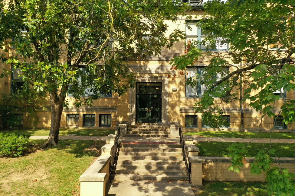
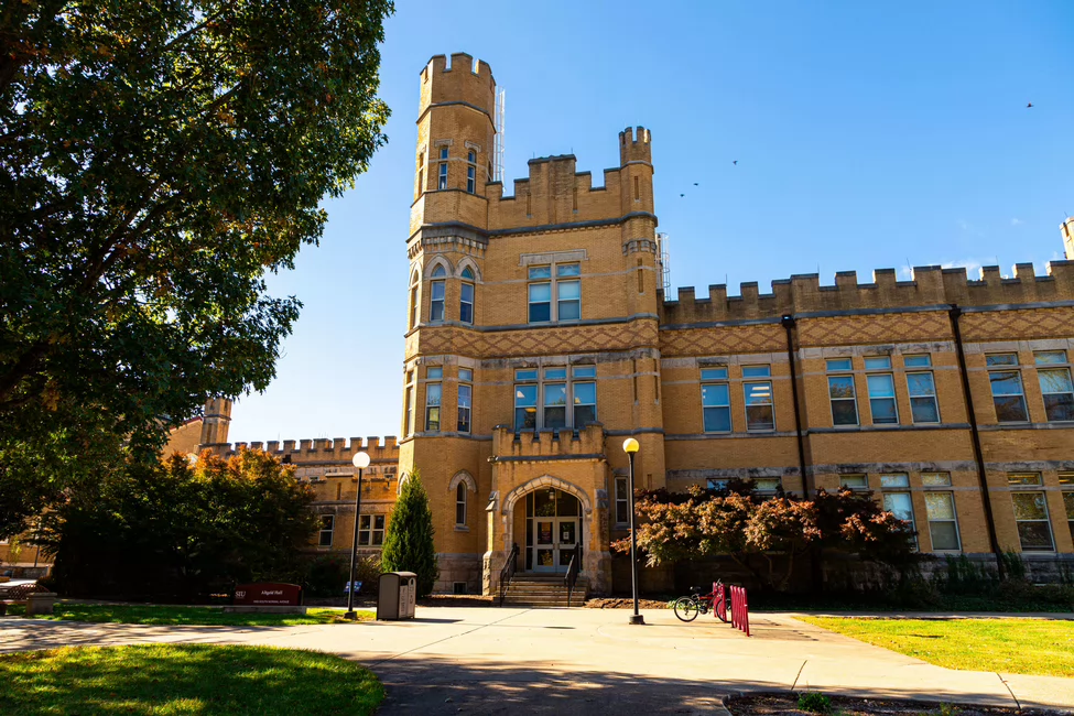
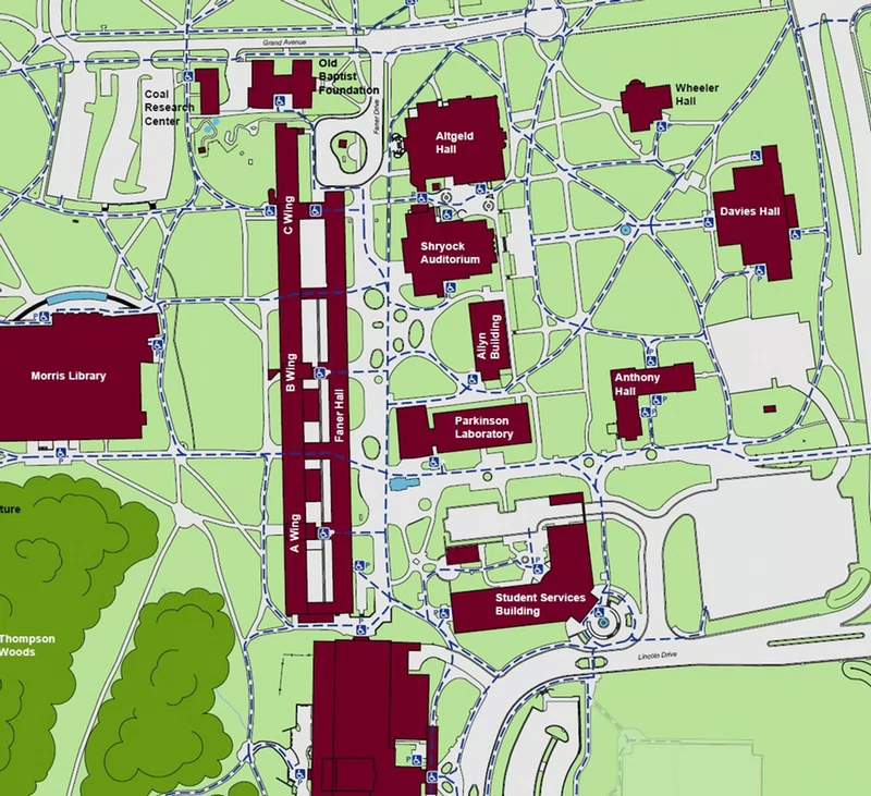
Altgeld Hall
Accessible Pathways and Entrances
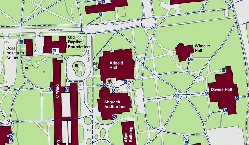
This map does not display every accessible pathway or powered door on campus. Doors marked with “P” indicate powered entrances. Pathways shown with blue dashed lines indicate accessible pedestrian routes.
Altgeld Hall is centrally located and highlighted in dark red. Accessible pedestrian routes are shown as blue dashed lines and connect Altgeld Hall to nearby buildings and surrounding roadways.
To the north of Altgeld Hall:
- Grand Avenue
- Accessible pedestrian routes along the roadway
To the east:
- Davies Hall
- Wheeler Hall
- Accessible pedestrian routes along the roadway
To the south:
- Allyn Building
- Shryock Auditorium
- Coal Research Center
- Faner Hall C Wing
- Old Baptist Foundation
- Faner Drive
- Accessible pedestrian routes along the roadway
Powered doors are marked with a “P” symbol at select entrances near:
- Altgeld Hall
- Davies Hall
- Wheeler Hall
Accessible pathways connect parking areas, sidewalks, and building entrances throughout the area shown.
Note: This map does not display every accessible pathway or powered door on campus.
| ADA Accessible Restrooms | Room |
|---|---|
| Men's | 0035, 0115, 0221 |
| Women's | 0037, 0105, 0223 |
| All Gender | 0304, 0305 |
Back to Top
Applied Sciences and Arts Building
1365 Douglas Dr, Carbondale, IL, 62901
Accessible Pathways and Entrances
This map does not display every accessible pathway or powered door on campus. Doors marked with “P” indicate powered entrances. Pathways shown with blue dashed lines indicate accessible pedestrian routes.
The Applied Sciences and Arts Building is centrally located and highlighted in dark red. Accessible pedestrian routes are shown as blue dashed lines and connect the Applied Sciences and Arts Building to nearby buildings and surrounding roadways.
To the north of the Applied Sciences and Arts Building
- Engineering Building
- Bucky's Haven
- Lincoln Drive
- Accessible pedestrian routes along the roadway
To the east:
- Bantera Center
- Lingle Hall
- Douglas Drive
- Accessible pedestrian routes along the roadway
To the south:
- Douglas Drive
- Lakeshore Drive
- Accessible pedestrian routes along the roadway
To the west:
- Boat Dock
- Ralph E. Becker Pavilion
- Oak Grove
Powered doors are marked with a “P” symbol at select entrances near:
- Applied Sciences and Arts Building
- Banterra Center
- Engineering Building
- Lingle Hall
Accessible pathways connect parking areas, sidewalks, and building entrances throughout the area shown.
Note: This map does not display every accessible pathway or powered door on campus.
| ADA Accessible Restrooms | Room |
|---|---|
| Men's | 0010C, 0010H, 0138, 0200C, 0228 |
| Women's | 0010G, 0100, 0136C, 0224 |
Back to Top
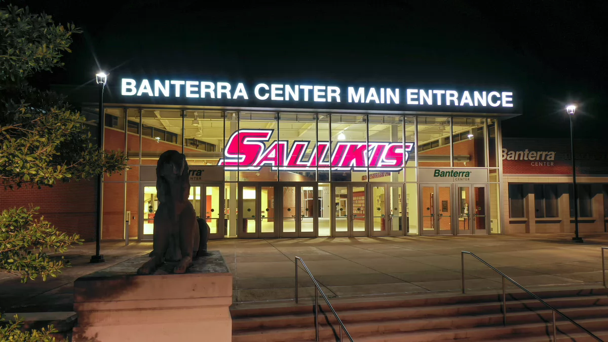
Banterra Center
Accessible Pathways and Entrances
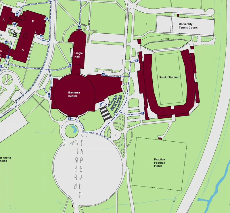
This map does not display every accessible pathway or powered door on campus. Doors marked with “P” indicate powered entrances. Pathways shown with blue dashed lines indicate accessible pedestrian routes.
Banterra Center is centrally located and highlighted in dark red. Accessible pedestrian routes are shown as blue dashed lines and connect Banterra Center to nearby buildings and surrounding roadways.
To the north of Banterra Center:
- Lingle Hall
- Douglas Drive
- Accessible pedestrian routes along the roadway\
- Saluki Stadium
- Practice Football Fields
- University Tennis Courts
- Marion Rushing Lane
To the south:
- Banterra Parking
- Applied Sciences and Arts Building
- Douglas Drive
- Accessible pedestrian routes along the roadway
Powered doors are marked with a “P” symbol at select entrances near:
- Applied Sciences and Arts
- Banterra Center
- Lingle Hall
Accessible pathways connect parking areas, sidewalks, and building entrances throughout the area shown.
Note: This map does not display every accessible pathway or powered door on campus.
| ADA Accessible Restrooms | Room |
|---|---|
| Men's | 0034, 0112, 0122, 0152, 0162 |
| Women's | 0038, 0114, 0124, 0154, 0164 |
| All Gender | 0123, 0153 |
Back to Top
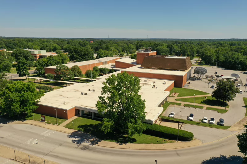
Communications Building
Accessible Pathways and Entrances
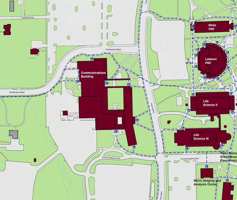
This map does not display every accessible pathway or powered door on campus. Doors marked with “P” indicate powered entrances. Pathways shown with blue dashed lines indicate accessible pedestrian routes.
The Communications Building is centrally located and highlighted in dark red. Accessible pedestrian routes are shown as blue dashed lines and connect the Communications Building to nearby buildings and surrounding roadways.
To the north of the Communications Building:
- Chautauqua Street
- Accessible pedestrian routes along the roadway
To the east:
- Lawson Hall
- Rehn Hall
- Life Sciences II
- Life Sciences III
- Micor Imaging and Analysis Center
- Plant Biology Greenhouse Conservation
- Lincoln Drive
- Accessible pedestrian routes along the roadway
To the south:
- Communications Drive
- Accessible pedestrian routes along the roadway
- Chautauqua Street
- Accessible pedestrian routes along the roadway
Powered doors are marked with a “P” symbol at select entrances near:
- Communications Building
- Lawson Hall
- Life Sciences II
- Life Sciences III
Accessible pathways connect parking areas, sidewalks, and building entrances throughout the area shown.
Note: This map does not display every accessible pathway or powered door on campus.
| ADA Accessible Restrooms | Room |
|---|---|
| Men's | 1002, 2025 |
| Women's | 1001, 2024 |
| All Gender | 0003, 0005, 1083, Semi-Private 1043A |
Back to Top
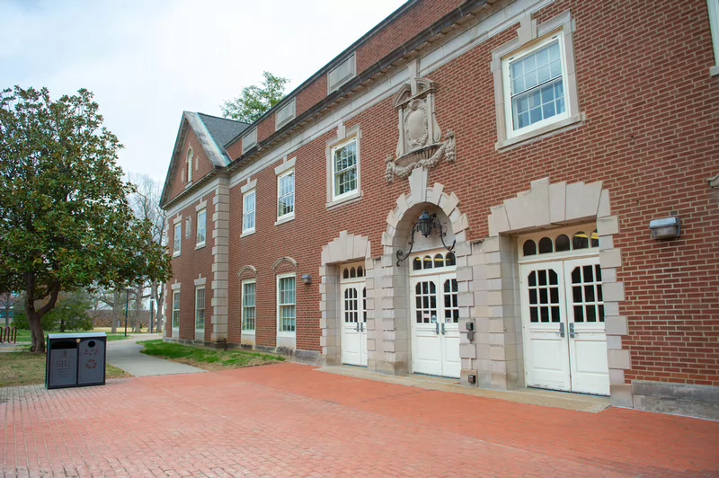
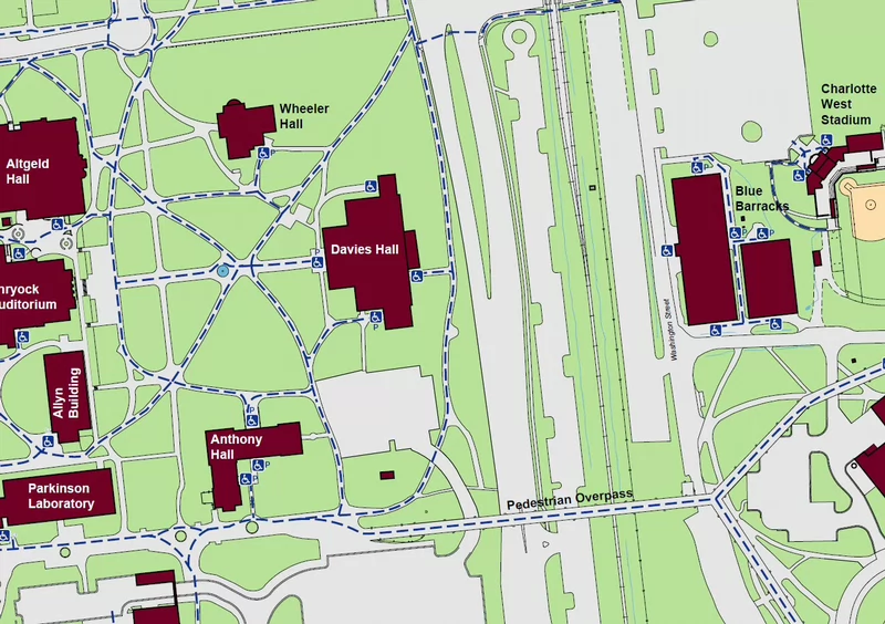
Davies Hall
Accessible Pathways and Entrances
This map does not display every accessible pathway or powered door on campus. Doors marked with “P” indicate powered entrances. Pathways shown with blue dashed lines indicate accessible pedestrian routes.
Davies Hall is centrally located and highlighted in dark red. Accessible pedestrian routes are shown as blue dashed lines and connect the Davies Hall to nearby buildings and surrounding roadways.
To the north of Davies Hall:
- Wheeler Hall
- Blue Barracks
- Charlotte West Stadium
- Route 51
- Accessible pedestrian routes along the roadway
To the south:
- Pedestrian Overpass
- Main campus pathways with marked accessible crossings
- Allyn Building
- Altgeld Hall
- Parkinson Laboratory
- Shryock Auditorium
- Main campus pathways with marked accessible crossings
Powered doors are marked with a “P” symbol at select entrances near:
- Allyn Building
- Anthony Hall
- Blue Barracks
- Davies Hall
- Parkinson Laboratory
- Wheeler Hall
Accessible pathways connect parking areas, sidewalks, and building entrances throughout the area shown.
Note: This map does not display every accessible pathway or powered door on campus.
| ADA Accessible Restrooms | Room |
|---|---|
| Men's | 0105 |
| Women's | 0103 |
Back to Top
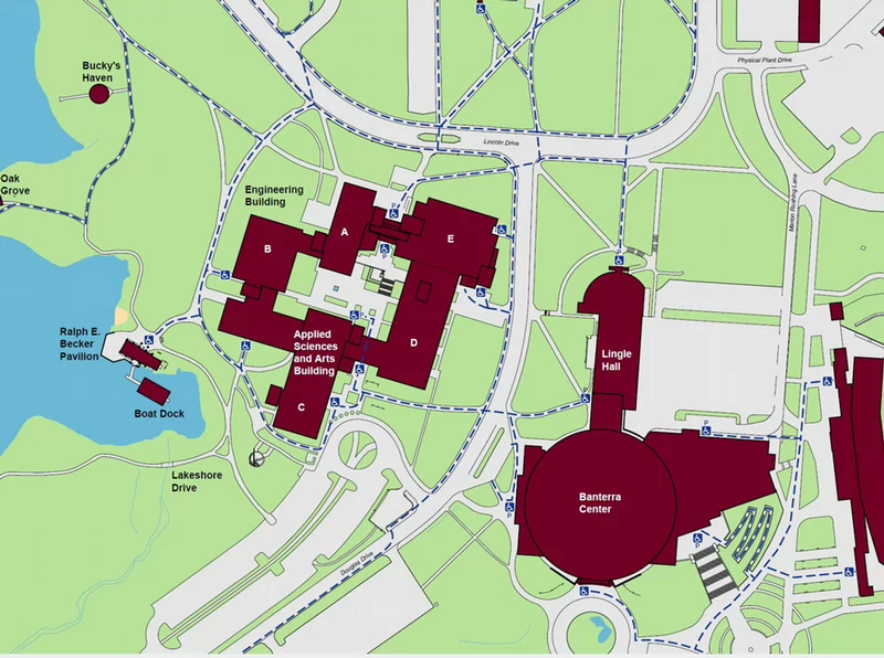
Engineering Building
1230 Lincoln Dr, Carbondale, IL, 62901
Accessible Pathways and Entrances
This map does not display every accessible pathway or powered door on campus. Doors marked with “P” indicate powered entrances. Pathways shown with blue dashed lines indicate accessible pedestrian routes.
The Engineering Building is centrally located and highlighted in dark red. Accessible pedestrian routes are shown as blue dashed lines and connect the Engineering Building to nearby buildings and surrounding roadways.
To the north of the Engineering Building
- Bucky's Haven
- Lincoln Drive
- Accessible pedestrian routes along the roadway
To the east:
- Bantera Center
- Lingle Hall
- Douglas Drive
- Accessible pedestrian routes along the roadway
To the south:
- Applied Sciences and Arts Building
- Douglas Drive
- Lakeshore Drive
- Accessible pedestrian routes along the roadway
To the west:
- Boat Dock
- Ralph E. Becker Pavilion
- Oak Grove
Powered doors are marked with a “P” symbol at select entrances near:
- Applied Sciences and Arts Building
- Banterra Center
- Engineering Building
- Lingle Hall
Accessible pathways connect parking areas, sidewalks, and building entrances throughout the area shown.
Note: This map does not display every accessible pathway or powered door on campus.
| ADA Accessible Restrooms | Room |
|---|---|
| Men's | A: 0044, 0128, 0134; E: 0033, 0126, 0228 |
| Women's | A: 0042, 0132; E: 0032, 0125, 0227 |
Faner Hall
Accessible Pathways and Entrances
This map does not display every accessible pathway or powered door on campus. Doors marked with “P” indicate powered entrances. Pathways shown with blue dashed lines indicate accessible pedestrian routes.
Faner Hall is centrally located and highlighted in dark red. Accessible pedestrian routes are shown as blue dashed lines and connect Faner Hall to nearby buildings and surrounding roadways.
To the north of Faner Hall
- Coal Research Center
- Old Baptist Foundation
- Faner Drive
- Grand Avenue
- Accessible pedestrian routes along the roadway
To the east:
- Allyn Building
- Altgeld Hall
- Anthony Hall
- Davies Hall
- Parkinson Laboratory
- Shryock Auditorium
- Student Services Building
- Wheeler Hall
- Lincoln Drive
- Route 51
- Accessible pedestrian routes along the roadway
To the south:
- Student Center
To the west:
- Morris Library
- Thompson Woods
- Allyn Building
- Altgeld Hall
- Davies Hall
- Faner Hall
- Morris Library
- Parkinson Laboratory
- Shryock Auditorium
- Student Center
- Student Services Building
- Wheeler Hall
Accessible pathways connect parking areas, sidewalks, and building entrances throughout the area shown.
Note: This map does not display every accessible pathway or powered door on campus.
| ADA Accessible Restrooms | Room |
|---|---|
| Men's | 1036, 2308, 3308, 4308 |
| Women's | 1034, 2307, 3307, 4406 |
Back to Top
Paul Simon Public Policy Institute (Forestry Building)
Accessible Pathways and Entrances
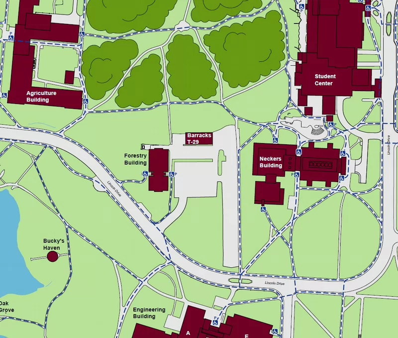
This map does not display every accessible pathway or powered door on campus. Doors marked with “P” indicate powered entrances. Pathways shown with blue dashed lines indicate accessible pedestrian routes.
The Forestry Building is centrally located and highlighted in dark red. Accessible pedestrian routes are shown as blue dashed lines and connect the Forestry Building to nearby buildings and surrounding roadways.
To the north of the Forestry Building
- Thompson Woods
To the east:
- Barracks T-29
- Neckers Building
- Student Center
- Lincoln Drive
- Accessible pedestrian routes along the roadway
To the south:
- Engineering Building
- Lincoln Drive
- Accessible pedestrian routes along the roadway
To the west:
- Agriculture Building
- Bucky's Haven
- Oak Grove
- Lincoln Drive
- Accessible pedestrian routes along the roadway
Powered doors are marked with a “P” symbol at select entrances near:
- Agriculture Building
- Engineering Building
- Forestry Building
- Neckers Building
- Student Center
Note: This map does not display every accessible pathway or powered door on campus.
| ADA Accessible Restrooms | Room |
|---|---|
| Men's | 0122 |
| All Gender | 0103 |
Gower Translational Research Center
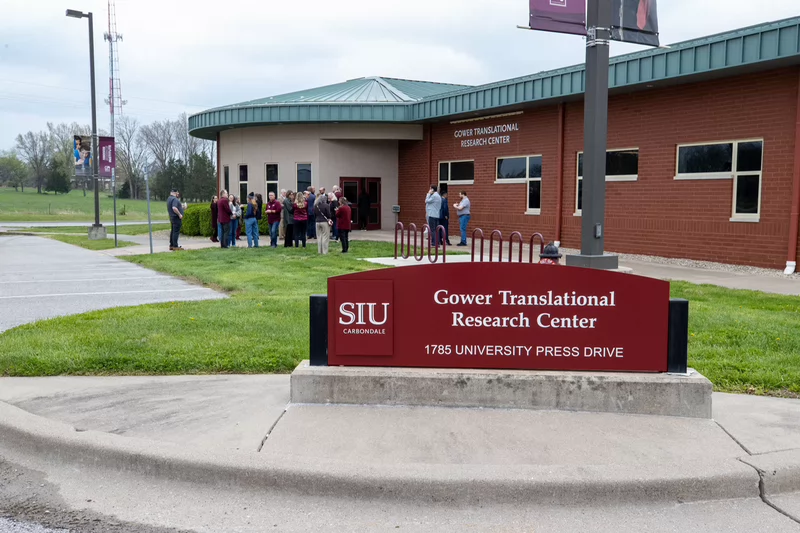
Accessible Pathways and Entrances
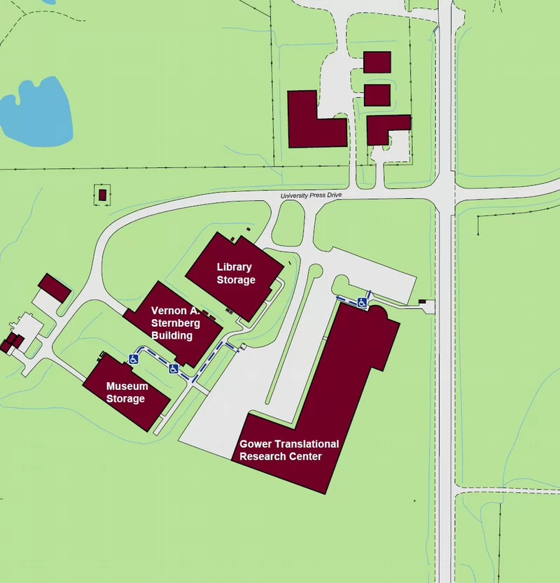
This map does not display every accessible pathway or powered door on campus. Doors marked with “P” indicate powered entrances. Pathways shown with blue dashed lines indicate accessible pedestrian routes.
The Gower Translational Research Center is centrally located and highlighted in dark red. Accessible pedestrian routes are shown as blue dashed lines.
To the north of the Gower Translational Research Center
- University Press Drive
To the east:
- McLafferty Rd
To the west:
- Library Storage
- Museum Storage
- Vernon A Sternberg Building
Accessible pathways connect parking areas, sidewalks, and building entrances throughout the area shown.
Note: This map does not display every accessible pathway or powered door on campus.
| ADA Accessible Restrooms | Room |
|---|---|
| Men's | 0103, 0132 |
| Women's | 0107, 0138 |
| All Gender | 0134 |
Back to Top
Grinnell Hall
275 E Park St, Carbondale, IL 62901
Accessible Pathways and Entrances
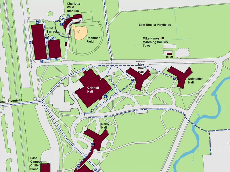
This map does not display every accessible pathway or powered door on campus. Doors marked with “P” indicate powered entrances. Pathways shown with blue dashed lines indicate accessible pedestrian routes.
Grinnell Hall is centrally located and highlighted in dark red. Accessible pedestrian routes are shown as blue dashed lines and connect the Grinnell Hall to nearby buildings and surrounding roadways.
To the north of Grinnell Hall
- Blue Barracks
- Charlotte West Stadium
- Rochman FIeld
- Park Street
- Accessible pedestrian routes along the roadway
To the east:
- Mae Smith Hall
- Mike Hanes Marching Saluki Tower
- Schneider Hall
- Logan Drive
- Park Street
- Sam Rinella Playfields
- Accessible pedestrian routes along the roadway
To the south:
- East Campus Chiller Plant
- Neely Hall
- Pedestrian Overpass
- Route 51
- Accessible pedestrian route along the overpass
Powered doors are marked with a “P” symbol at select entrances near:
- Blue Barracks
- Grinnell Hall
Accessible pathways connect parking areas, sidewalks, and building entrances throughout the area shown.
Note: This map does not display every accessible pathway or powered door on campus.
| ADA Accessible Restrooms | Room |
|---|---|
| All Gender | 0104 |
| Accessible Restrooms | Room |
|---|---|
| Men's | 0114 |
| Women's | 0108 |